Exhaustive, illustrated trail-guides, with detailed trekking maps, on the most popular treks in the Himalayas

Home
Guidebooks
Trekking Maps
Buy Online
Contact Us

Everest: Trekking Map

Buy Now

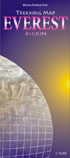
Detailed, easy-to-read fold-out map showing all major
trails. Contour-coloured so that users can visualise
the lay of the land, picturing mountain ranges and other relief features with ease.

The map covers the Everest and Gokyo regions and beyond,
from Lukla all the way to the Rongbuk Glacier in Tibet and
as far as Mt Makalu in the east. Shown in detail are the trails
to RenjoLa Pass, Mera Peak, and Island Peak and through
AmphuLapcheLa Pass and the Hongu valley.

Most major settlements and campsites shown on the trails, as
also peaks, are marked along with their altitudes, in both
metres and feet.

Click to view a section of the map in true scale

Everest
Trekking Map
Fold-out map enclosed in folder
Folder size: 4.5x10.25in./ 11.4x26 cm
Scale 1:100,000
Map size 29 x 27 in./ 73.5 x 68.5 cm
Published in 2009
by Milestone Books, India
Price US$ 5.00
(plus shipping and handling)
Price in India Rs 225
(plus Rs 50 for shipping and handling)


Home  |  Browse Books  |  Buy Online  |  Contact UsLinksSite Map

[© 2006-2021 Milestone Books, Calcutta, India.] [Best viewed IE 6.0 and above at 800x600 pixel display]